


Filters

Stock vector images of Geografisch
Discover royalty-free, professionally-designed vector art of Geografisch for personal and commercial use.

Map of styria with highways

Map of vorarlberg with highways

Map of Finland with highways

Map of Thailand with highways in gray

Map of Netherlands with highways in pastel orange

Map of Sweden with highways in pastel orange

West european country germany and the federal states

Map of thuringia with highways

European country Czech Republic and detailed regions

Political map of Democratic Republic Congo on white background

Map of Denmark with highways in pastel orange

Flat design with people. CDN - Content Delivery Network acronym. business concept background. Vector illustration for website banner, marketing materials, business presentation, online advertising

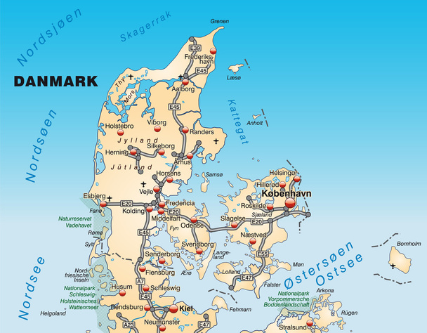
Map of Denmark with highways

The Aegean Sea is an elongated embayment of the Mediterranean Sea located between the Greek and Anatolian peninsulas, i.e., between the mainlands of Greece and Turkey.

Cayman Islands map vector illustration, scribble sketch Cayman Islands

Map of Saxony with highways in pastel orange

Map of Saarland with highways

Map of styria with highways

Map of Afghanistan with highways in pastel green

Map of Saxony with highways in blue

Map of Burgenland with highways in pastel green

Map of vorarlberg with highways in pastel green

Map of Afghanistan with highways in gray

European country United Kingdom and regions of England

Saskatchewan province administrative map isolated on white background, Canada

Nebraska State isolated map. Black outlines on white background.

Vector map of Democratic Republic Congo isolated on transparent background

Slovakia is a landlocked country in the eastern part of Central Europe

Vector administrative and political map of the Republic of Uganda

Map of Argentina with states isolated

Taipei, Taiwan streets, roads, avenues, transportation vector map

Burma map, web simple illustration

Map of Spain with highways in pastel orange

Map of Italy with highways in pastel orange

Map of Denmark with highways in pastel green

Map of Saxony with highways in pastel green

Map of Portugal with highways in pastel green

Map of Bavaria with highways in pastel green

Map of tyrol with highways in pastel green

Map of Spain with highways in pastel green

Italy, officially the Italian Republic is a unitary parliamentary republic in Europe.

Administrative map of the regions in Canada s province of Ontario

Map of Germany with highways in yellow

European country germany and the federal states

Map of Thailand with highways in pastel green

Democratic Republic of Congo map vector illustration, scribble sketch Congo

Vector map of the french island saint pierre and miquelon

Map of salzburg with highways in gray

Map of Hamburg with highways in green

Map of Brandenburg with highways in pastel green

Map of Germany with highways in pastel green

Map of Germany with highways in bronze

Democratic republic of the congo africa map country on white background. Democratic Republic of the Congo flag map. flat style.

Chile is a South American country occupying a long, narrow strip of land between the Andes to the east and the Pacific Ocean to the west

Map of the territorial community of Saint-Pierre and Miquelon, France

Vector illustration of administrative division map of Madagascar. Vector Madagascar map.

Environmental concept: Sustainable, low-CO2 energy generation represented by related symbols. vector

Flat design with people. CDN - Content Delivery Network acronym. business concept background. Vector illustration for website banner, marketing materials, business presentation, online advertising
"Oklahoma map" flat icon, vector illustration

Tajikistan map, vector illustration simple design

Democratic Republic of the Congo, graphic vector illustration

United Kingdom map, graphic vector illustration

The Bahamas map, web simple illustration

Kenya map, vector illustration simple design

Vector map flag of Democratic Republic of the Congo isolated on white background

European country Denmark and detailed regions

Map of Lower Saxony with highways

Map of kaernten with highways

Map of Saxony with highways

Map of Thailand with highways

Map of upper Austria with highways in pastel green

Map of Lower Saxony with highways in pastel green

Map of Portugal with highways

European country United Kingdom and regions of England
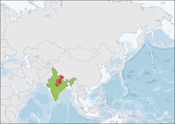
India is a country in South Asia

Latvia country detailed editable map with regions cities and towns, roads and railways, geographic sites. Vector EPS-10 file

Vector website design template . CDN - Content Delivery Network acronym, business concept. illustration for website banner, marketing materials, business presentation, online advertising.

Climate neutral globe and hand with leaves. vector

Equatorial Guinea map, graphic vector illustration
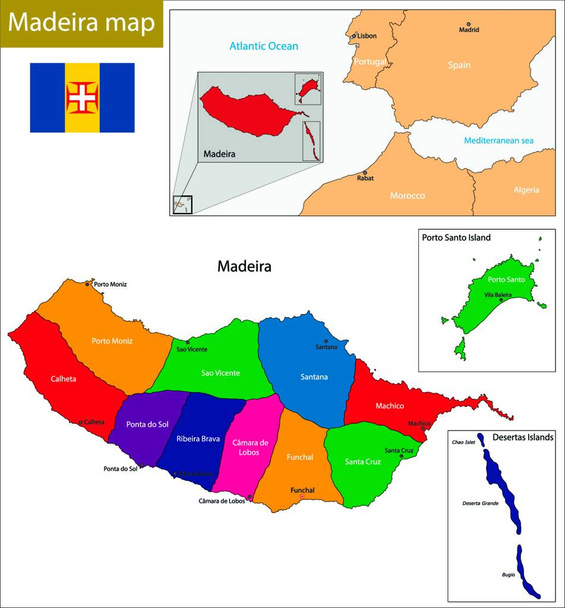
Madeira map, web simple illustration

Wisconsin map, web simple illustration

Europe is a continent that comprises the westernmost part of Eurasia.

Montenegro is a sovereign state in Southeastern Europe

Map of Afghanistan with highways in pastel orange

Map of Thailand with highways in pastel green

Map of Austria with highways in pastel green
Map of Denmark with highways in pastel orange

Map of Saxony with highways in pastel orange

Map of Sweden with highways in pastel orange

Map of Norway with highways

Map of Bavaria with highways in pastel green

Map of Brandenburg with highways in pastel green

Map of Saarland with highways in green

Map of salzburg with highways in pastel green

Map of Saxony with highways in pastel green

Map of Lower Saxony with highways in pastel orange

Map of upper Austria with highways in pastel orange

Map of Lower Saxony with highways

Map of upper Austria with highways in gray

Map of styria with highways in pastel green