Social Media


Popular features
Photo

Filters

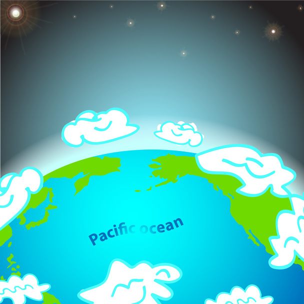
Stock vector images of Тихоокеанский регион
Discover royalty-free, professionally-designed vector art of Тихоокеанский регион for personal and commercial use.

Map the State of Hawaii in gray on a white background

Hawaii dark silhouette map isolated on white background

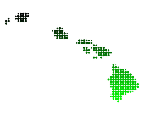
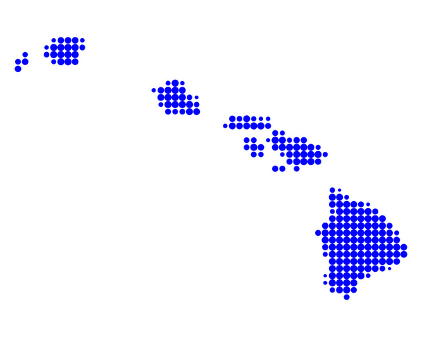
A dot map of Hawaii isolated on a white background

Map of Hawaii

Tonga map in gray on a white background

Highly Detailed Hawaii Silhouette map.
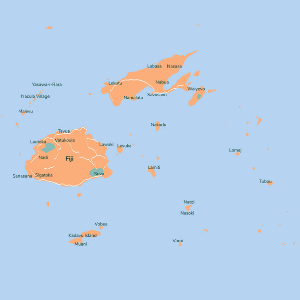
Vector map Fiji. Isolated vector Illustration. Black on White background. EPS 10 Illustration.

Country map silhouette of Tonga in Oceania
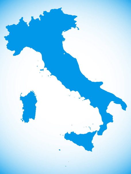
Blue Map of European Country of Italy on Blue Gradient Background

Black Silhouette Map of European Country of Norway With a Reflection on a Gray Gradient Background

Black Flat Map of the European Country of Spain on a Gray Gradient Background
Set of monochrome icons with world continents for your design
Map of Hawaii

TRENGGANU map black silhouette on white background
Map of Hawaii

Australian silhouette map over an ocean background

Vector map Papua New Guinea. Isolated vector Illustration. Black on White background. EPS 10 Illustration.
Monochrome vector icons with world continents

Blank map of Samoa. High quality map Independent State of Samoa with provinces on transparent background for your web site design, app, UI. Oceania. EPS10.

Map of Argentina in gray on a white background

Highly detailed Russian Federation map with borders isolated on background

Vector map Fiji. Isolated vector Illustration. Black on White background. EPS 10 Illustration.

Chinandega Department (Republic of Nicaragua, Departments of Nicaragua) map vector illustration, scribble sketch Chinandega (NI-CI) map

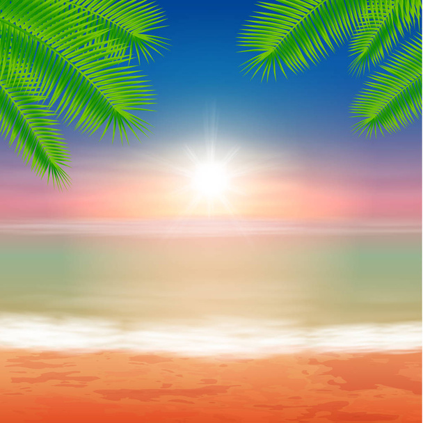
Tropical sunny beach. Vector Illustration.

Black and white map of South Korea

The political detailed map of the continent of North America with borders

Vector map Solomon islands. Isolated vector Illustration. Black on White background. EPS 10 Illustration.

Highly detailed Norway map with borders isolated on background

Highly detailed Pakistan map with borders isolated on background

Vector map Solomon islands. Isolated vector Illustration. Black on White background. EPS 10 Illustration.

Highly detailed Norway map with borders isolated on background

Isolated vector Illustration. Black on White background. EPS 10 Illustration

White map of Japan map on blue background

Vector Image - Map of Brunei Darussalam with with Dot Pattern

Beach background vector

Abstract map of China from round dots. Vector illustration. Eps10

Black and white map of Japan

Black Silhouette Map of European Country of Spain With a Reflection on a Gray Gradient Background

Political map of South America with all countries and national borders. Blue outline illustration on white background and english scaling.

Blue Map of European Country of Ukraine on Blue Gradient Background

Vanuatu map vector illustration, scribble sketch Republic of Vanuatu, New Hebrides,

Vector map Solomon islands. Isolated vector Illustration. Black on White background. EPS 10 Illustration.

Painting watercolor vector seascape top view colorful of people, family summer holiday and tourism in summer with multi colored umbrella sea wave blue background, For wallpaper abstract illustration.

Vector map Samoa. Isolated vector Illustration. Black on White background. EPS 10 Illustration.

Vector halftone Dotted map of Fiji country for your design, Travel Illustration concept.

Dawson island (Republic of Chile, South and Latin America, Tierra del Fuego Archipelago) map vector illustration, scribble sketch Isla Dawson map

Highly detailed Pakistan map with borders isolated on background

White map of South Korea with red push pin

Desolacion island (Republic of Chile, South and Latin America, Tierra del Fuego Archipelago) map vector illustration, scribble sketch Isla Desolacion map

Canada country grey vector map on isolated white background for travel, and geography concepts.

Vector map Fiji. Isolated vector Illustration. Black on White background. EPS 10 Illustration.

White map of Argentina with red push pin in the position of Buenos Aires
Beach and tropical sea with bright sun and palmtree leaves. Summer background. EPS10 vector.

Normanby island (Papua New Guinea, D'Entrecasteaux Islands Archipelago) map vector illustration, scribble sketch Normanby map

Princess Royal island (Canada, British Columbia Province, North America) map vector illustration, scribble sketch Princess Royal map

Beach and tropical sea with bright sun and palmtree leaves. Colorful summer background. EPS10 vector.

Concept map of Canada, vector design Illustration

Northern Division (Republic of Fiji, Melanesia) map vector illustration, scribble sketch Vanua Levu Island map

Blue Map of European Country of Belgium on Blue Gradient Background

Administrative and political map of Central America and the Caribbean countries
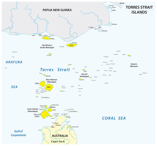
Map of the Australian Torres Strait Islands

MALINDI map colorful silhouette on white background

Hawaii national vector drawing map on white background

Vector map Solomon islands. Isolated vector Illustration. Black on White background. EPS 10 Illustration.

Bora Bora Map with nice background. Detailed vector illustration. Isolated concept for infographic and marketing.

Map of panama. High detailed vector map - panama.

Hoste island ( Republic of Chile, South and Latin America, Tierra del Fuego Archipelago) map vector illustration, scribble sketch Isla Hoste map

Indonesia highly detailed physical map,in vector format,with all the relief forms,regions and big cities.

ADAKGILIYAH map silhouette on white background

Subregions and countries of Oceania

Vanuatu political map with capital Port Vila and English labeling. Republic, archipelago and island nation in the South Pacific Ocean. Gray illustration on white background. Vector.

Abstract black outline of Japan map

Tabar Group islands (New Guinea, Pacific Ocean, Bismarck Archipelago) map vector illustration, scribble sketch Tabar, Tatau and Simberi island map

Map of Africa. With shadow and the inscription

Tonga map with flag inside and ribbon

Chile highly detailed vector map with administrative regions, main cities and roads.

New Zealand - map is designed rainbow abstract colorful pattern, New Zealand (North and South Island) map made of color explosion,

Blue map of Japan with red push pin indicating the position of Tokyo
Farallon de Medinilla Island (Commonwealth of the Northern Mariana Islands, Pacific Ocean, United States of America, USA) map vector illustration, scribble sketch map

Map of the Channel Islands National Park

Vector map South Korea. Isolated vector Illustration. Black on White background. EPS 10 Illustration.

Illustration of Summer in beach on background

Easter Island or Rapa Nui political map with shadow

Map of Canada in gray on a white background

Vector map Canada. Isolated vector Illustration. Black on White background. EPS 10 Illustration.

Simple map of New Zealand with degrees of longitude and latitude
Manuae island (France, French Republic, Pacific Ocean, Society Islands Archipelago, French Polynesia) map vector illustration, scribble sketch Manua'e or Scilly map

Sky with clouds over the ocean. Empty sandy beach in summer. Waves on the seashore. Sunrise. Abstract vector illustration.

Tetiaroa island (France, French Republic, Pacific Ocean, Society Islands Archipelago, French Polynesia) map vector illustration, scribble sketch Tetiaroa map

Vector color western samoa map

Norfolk Island map silhouette vector illustration eps 10.

Vector map Tonga. Isolated vector Illustration. Black on White background. EPS 10 Illustration.

Vector Stock Ilustration - world map

Marshall Islands political map with capital Majuro. Republic and island country near the equator in the Pacific Ocean in Micronesia. English labeling. Illustration.

Hand drawn watercolor map of Bolivia isolated. Vector version
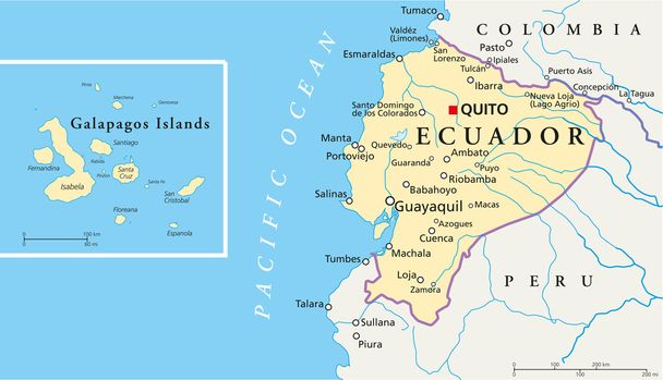
Political map of Ecuador and Galapagos Islands with the capital quito, national borders, most important cities, rivers and lakes. Vector illustration with english labeling and scale.

The Ecuador region map in South America