


Filters

Stock royalty-free photos and images of Death valley
Discover unlimited high resolution images of Death valley and stock visuals for commercial use.

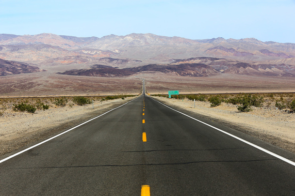
Death Valley national park, California, USA

Vintage toned desert road in Death Valley with amazing cloudscape, travel concept, USA.

View from Zabriskie Point, California, USA. Desert panorama. Geological formations.

Salted lake in the Death Valley, California, USA

A long trail marks the path of one of the mysterious moving rocks on Death Valley's Racetrack Playa.

Death valley national park on sunny day

Badwater basin death valley national park california

Road passing through landscape, Death Valley National Park, California, USA

Zabriskie Point is a part of Amargosa Range located in east of Death Valley noted for its erosional landscape. It is composed of sediments from Furnace Creek Lake, which dried up 5 million years ago

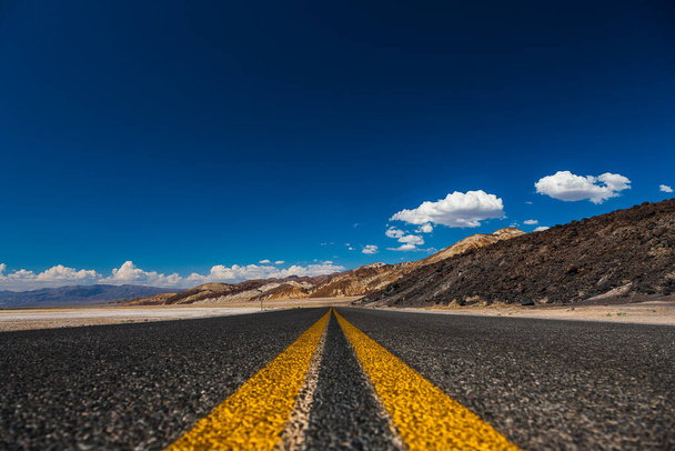
Road lines in death valley desert, california, usa

Road lines in death valley desert, california, usa

Image of Stunning detail of salt flat formations at Badwater Basin in Death Valley

Amazing view of colorful Artists Palette.Death Valley National Park.California.USA

Devil.

Vintage looking Zabriskie Point in Death Valley Nevada USA

In USA death valley park the beauty of amazing nature tourist destinatio

The long hot road in the death valley national park

Road lines in death valley desert, california, usa

Moving Stones at the Racetrack Playa in Death Valley, California with a depth of field

Mustard Canyon located near Furnace Creek in Death Valley National Park

Badwater Basin public boardwalk lowest point below sea level of Death Valley desolate desert landscape, Death Valley National Park, California, CA, USA

Sailing Stone at Racetrack Playa in Death Valley National Park, California, USA

Badwater Basin salt lake in Death Valley

Badwater, deepest point in the USA, Saltsee mixed with minerals in the Desert Valley, deeper than sea level

Driving on the Interstate 187 in Death valley direction Badwater in the heat of the Mojave Desert

Nadeau Trail is next to Darwin Wash and is located in Inyo County, California, United States. Nadeau Trail has a length of 1.81 kilometres.

Death Valley salt flats near the badwater area of the national park. The crusted salt rises to the desert surface and bakes in the sun.

Death Valley, California. Road in the middle of the desert

Death valley national park california

Death Valley national park, California, USA

Road to Death Valley National Park , California
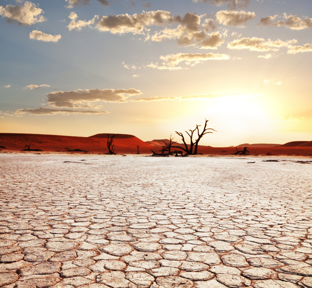
Dead valley in Namibia

Great American road, crossing a huge Death Valley in Nevadia

Image of Cracks in ground of salt flats with eroded salt formations in Death Valley

Death Valley, California, A sign for the Badwater Basin and pedestrians on path.

Image of Sandy desert road leading into mountains in Death Valley

Zabriskie point, death valley, california, usa

Badwater basin death valley national park california

Nadeau Trail is next to Darwin Wash and is located in Inyo County, California, United States. Nadeau Trail has a length of 1.81 kilometres.

Image of Red car during sharp turn in paved road surrounded by sandy desert and mountains

Winding road Artists drive in the Death Valley

Badwater Basin in Death Valley National Park, California, USA.Badwater is the lowest point in North America.

View of the salt pan in Death Valley National Park, the hottest places in the world. Mojave Desert, California, USA.

Zabriskie Point in Death Valley National Park , California, USA.
Road lines in death valley desert, california, usa

Zabriskie Point is a part of Amargosa Range located east of Death Valley in, Death Valley National Park in California

Zabriskie Point in Death Valley National Park, California, USA

Zabriskie point, Death Valley,CA

Eroding volcanic ash and silt hills, badlands, at Zabriskie Point, Death Valley National Park, California, USA

Scenic road and landscape in Death valley national park, USA

Death Valley road trip. Badwater Basin and mountains range

Panoramic view of hot summer road through the death valley, nevada

Death Valley National Park

Zabriskie point, death valley, california, usa

View from Zabriskie Point, California, USA. Desert panorama. Geological formations.

Open highway in Death Valley National Park, California, USA

Zabriskie point in Death Valley National Park, USA

Empty highway in deserted mountainous terrain, travel concept, USA.

Straight road passing through landscape, Death Valley National Park, California, USA

Zabriskie point, death valley, california, usa

Image of Lone shrub in an empty desert plain with mountains in background

High dynamic range (HDR) View of the ghost town of Rhyolite in Death Valley Nevada USA

Wooden viewing platform at the Badwater Basin, the second-lowest point in the Western Hemisphere, at sunset, Death Valley National Park, California, USA.

Salt Flats at Badwater Basin in Death Valley National Park, California,

Badwater Basin at sunset, Death Valley National Park, the lowest point in North America with elevation of 282 ft (86 m) below sea level, USA.

Nadeau Trail is next to Darwin Wash and is located in Inyo County, California, United States. Nadeau Trail has a length of 1.81 kilometres.

Salt Flats in Morning in Death Valley

Signage devils golf course in the deat valley

Death valley

Zabriske Point in Death Valley

Scenic road in the death valley national park with mountains and blue sky

Death Valley in California, the most arid place in USA

Twenty Mule Team Canyon Road, Death Valley National Park. 20-mule teams were teams of 18 mules and 2 horses attached to large wagons that ferried borax out of Death Valley from 1883 to 1889.

Badwater Basin salt lake in Death Valley

Death valley national park california

Zabriskie point, death valley, california, usa

Picture of a desert road, travel concept.

Vintage toned desert road in Death Valley, travel concept, USA.

Highway to the Death Valley

Road throught Death Valley in California

Wide open empty highway through Death valley, California, mountain view

Devils Golf Course in Death Valley National Park.

In USA death valley park the beauty of amazing nature tourist destinatio

Zabriskie point, death valley, california, usa

Bad water, deepest point in the USA, Saltsee mixed with minerals in the Desert Valley, deeper than sea level
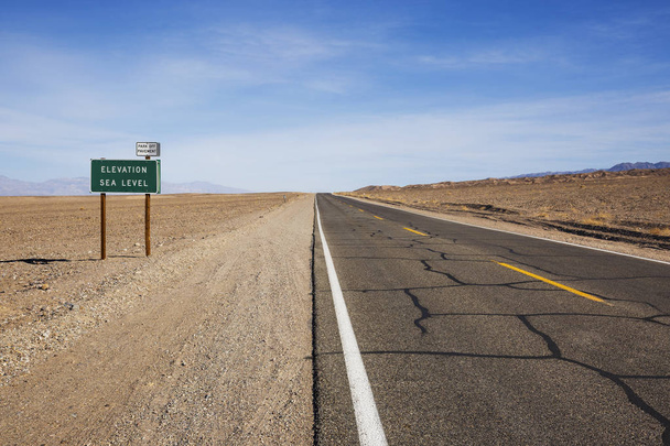
Elevation sea level sign, Death Valley National Park, California, USA

Death valley national park california

Badwater Basin in Death Valley National Park

Zabriskie Point is a part of Amargosa Range located in east of Death Valley in Death Valley National Park in the United States noted for its erosional landscape.

Road to Death Valley, California, USA

Vintage toned picture of a scenic sunset, Death Valley, USA.

In USA death valley park the beauty of amazing nature tourist destinatio

Death Valley, California. Panorama from Zabriesie Point at sunset

Ripples, curves, swirls and waves are numerous at Eureka Dunes at Death Valley National Park, California

Zabriskie Point, Death Valley

Scenic road and landscape in Death valley national park, USA

Zabriskie point, death valley, california, usa

Zabriskie Point is a part of Amargosa Range located in east of Death Valley in Death Valley National Park in the United States noted for its erosional landscape. It is composed of sediments from Furnace Creek Lake, which dried up 5 million years ago

Zabriskie Point in Death Valley National Park , California, USA.
The endless straight road through Death Valley in between hills and desert, Death Valley National Park, United States of America