


Filters

Stock vector images of Political map europe
Discover royalty-free, professionally-designed vector art of Political map europe for personal and commercial use.
Nice europe map isolated on white background
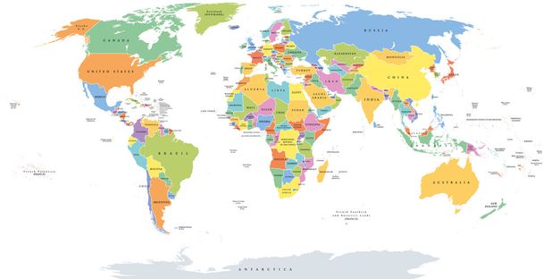
World single states political map with national borders. Each country area with its own color. Illustration on white background under Robinson projection. English labeling.
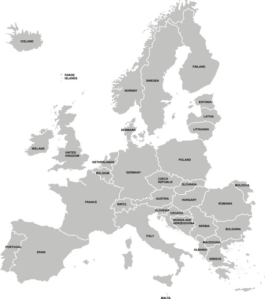
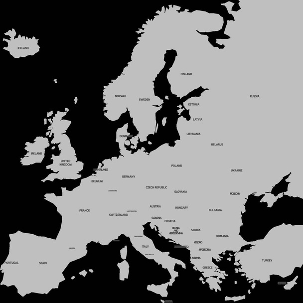
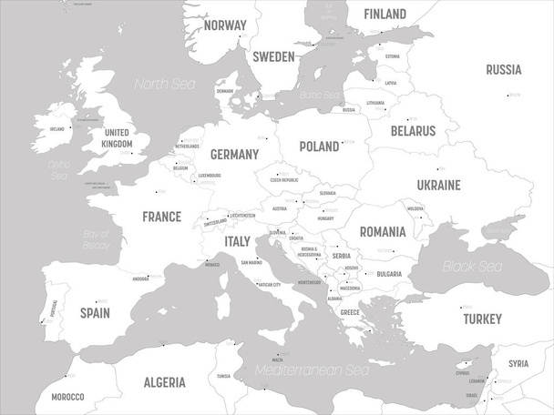
Political map of Europe continent in grey. With whole european part of Russia and Kazakhstan. Vector illustration.
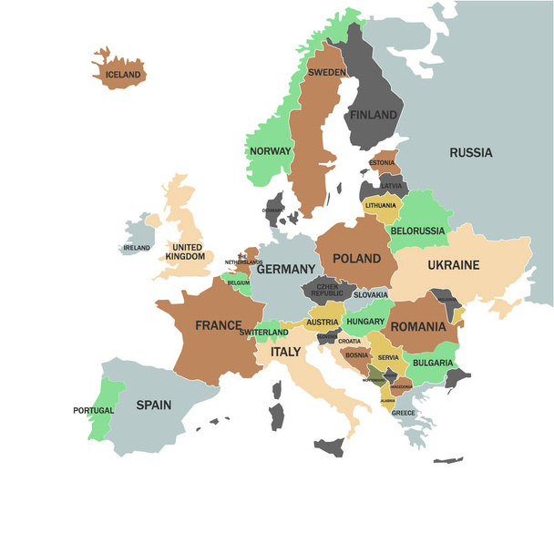
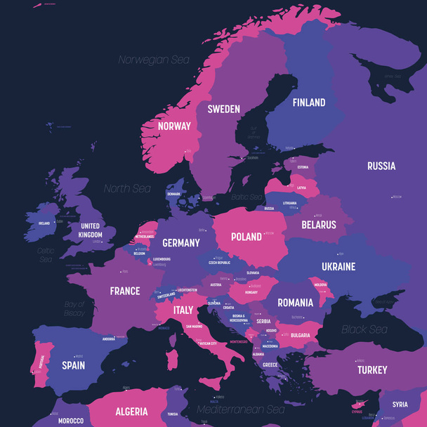
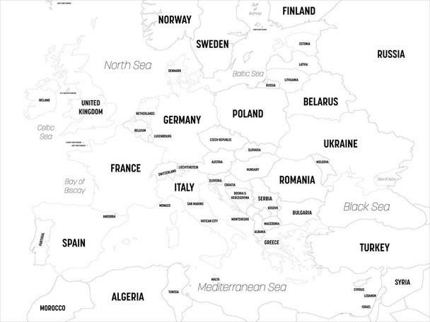
Europe map with names of sovereign countries
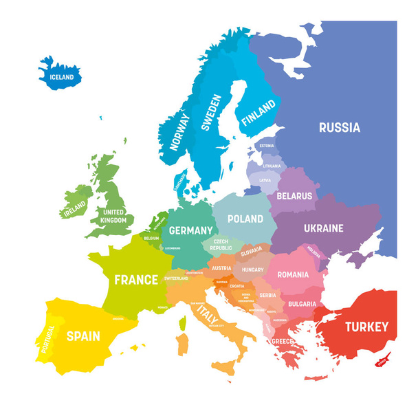
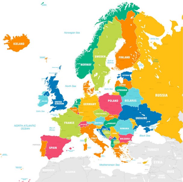
Map of Europe in colors of rainbow spectrum. With European countries names.

Europe Political Map and the surrounding region. Countries with national borders, big rivers and lakes. English scaling. Illustration.
World Map Vintage Political - Vector Illustration
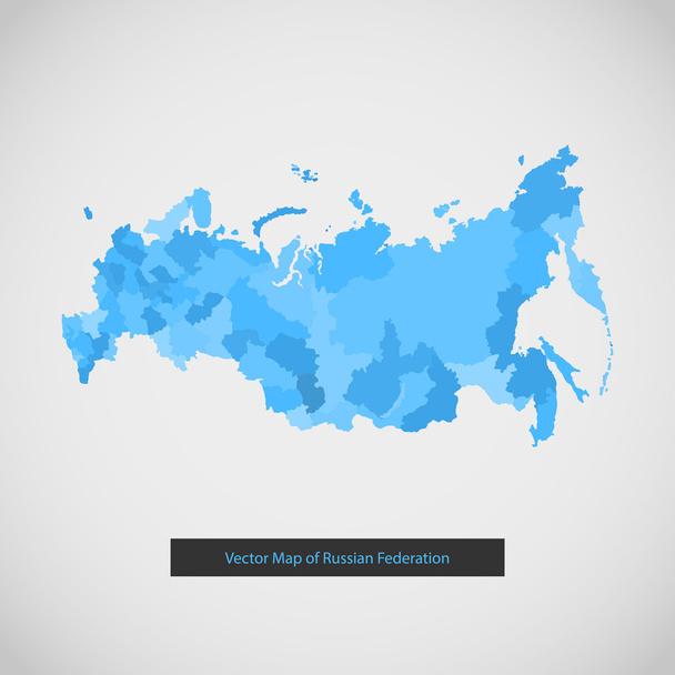
Russia map. Vector background illustration of Russian federation.
Vector map of European Continent with Countries, Capitals, Main Cities and Seas and islands names in strong brilliant colors.

Hand drawn watercolor map of Europe isolated on white. Vector version
Political map of Europe. European ministates included. Flat map on white background. Colorful vector illustration.
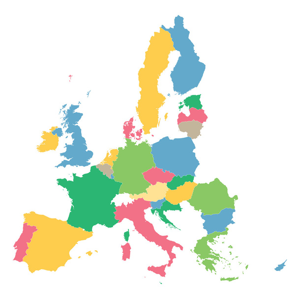
Colorful map of European Union
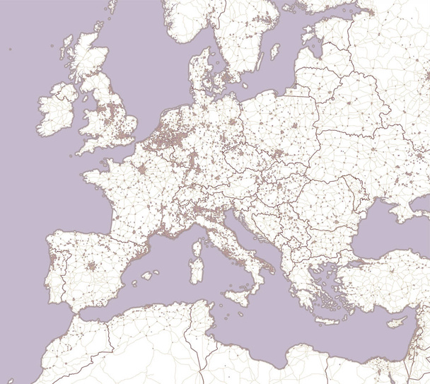
Street and political map of Europe and North Africa. European cities. Political map with the border of the states. Urban areas. Street directory, atlas.

European Union, isolated on white background, with all single countries. All 28 EU members, colored in blue. Political and economic union in Europe. Illustration. Vector.

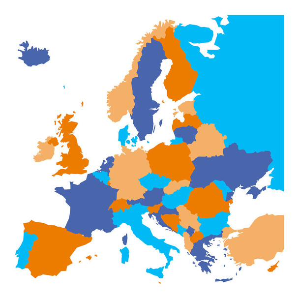
Political map of Europe continent in three color variants isolated on blank background. Vector illustration
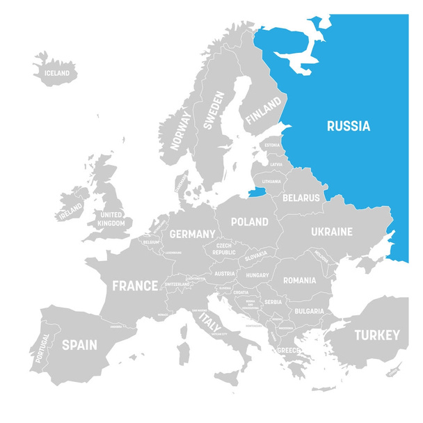
Russia marked by blue in grey political map of Europe. Vector illustration.

Railway and political map of Europe and North Africa. European cities. Political map with the border of the states. Urban areas. Railway line.

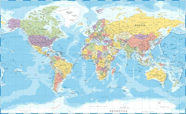
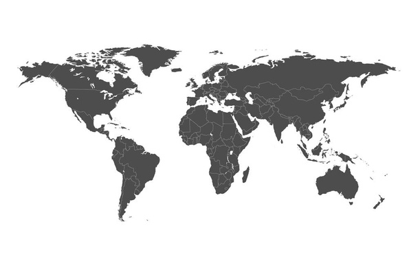
Political map of the world

World map - brown orange hue colored on dark background. High detailed political map of World with country, ocean and sea names labeling.
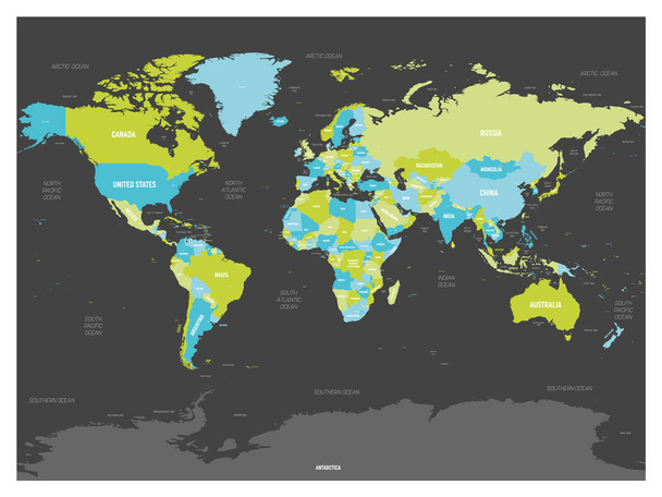
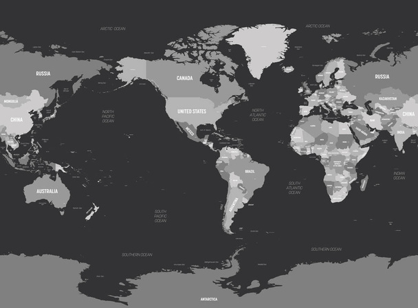
World map. High detailed political map of World with country, capital, ocean and sea names labeling. Colorful map on dark background.
Political map of the world
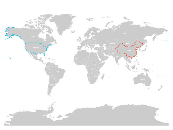
United States and China highlighted on political map of World. Vector illustration.
Europe - Political Map of Europe
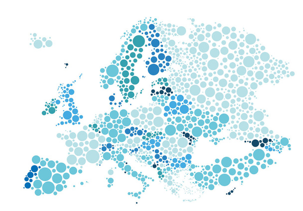
Vector illustration of political map of Europe designed with different sizes and tones of blue dots.
Political map of the world with separate countries. Editable stroke.
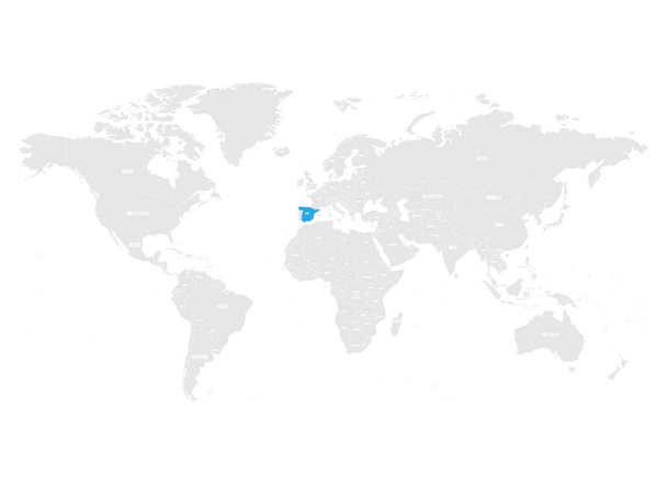
Spain marked by blue in grey World political map. Vector illustration.
Europe map. High detailed political map of european continent with country, capital, ocean and sea names labeling.

Luxembourg map highlighted in Luxembourg flag colors, gray map with neighboring countries.

Vector Dotted World Map. A political map of the World. Round dots
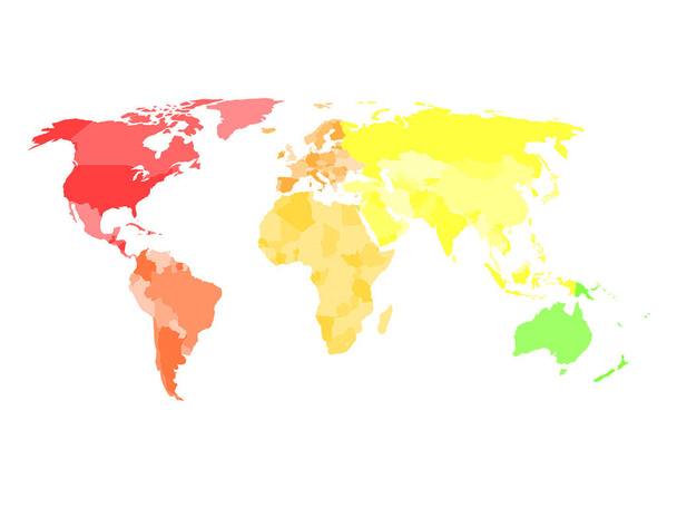
Blank simplified political map of world with different colors of each continent - North America, South America, Europe, Africa, Asia and Australia. Vector illustration
Europe map - white lands and grey water. High detailed political map of european continent with country, capital, ocean and sea names labeling.

World map separate individual states green yellow, political map vector
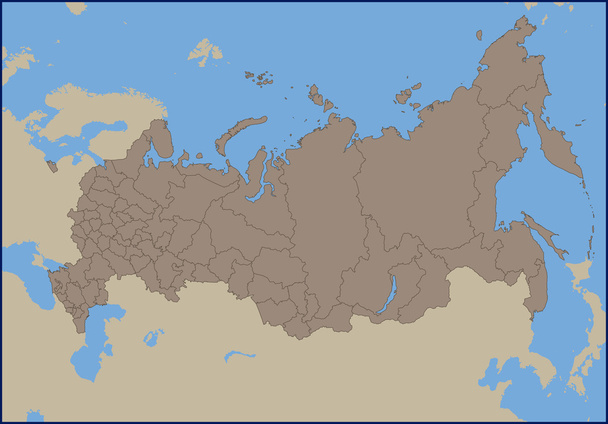
Illustration of a Empty Political Map of Russia

Political map abstract of the world background
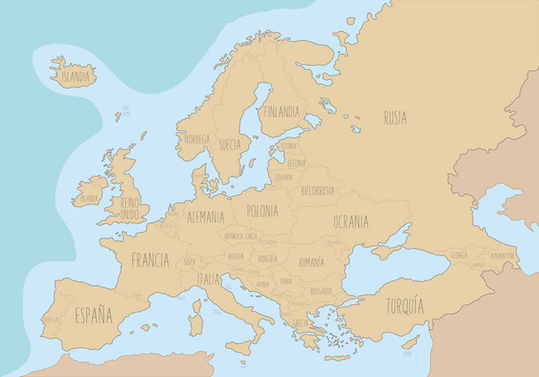
Political map of Europe with names in Spanish. Vector Illustration
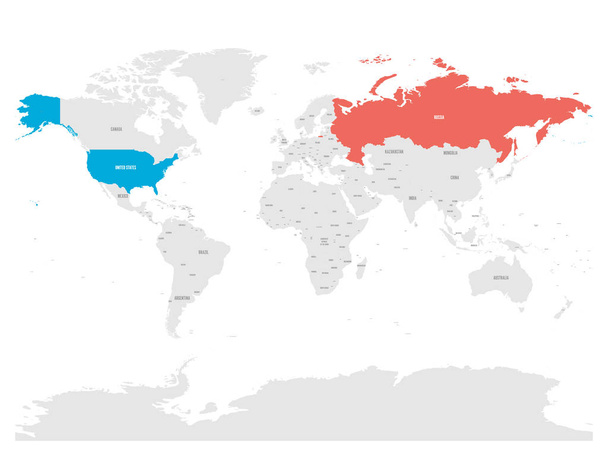
United States and Russia highlighted on political map of World. Vector illustration.
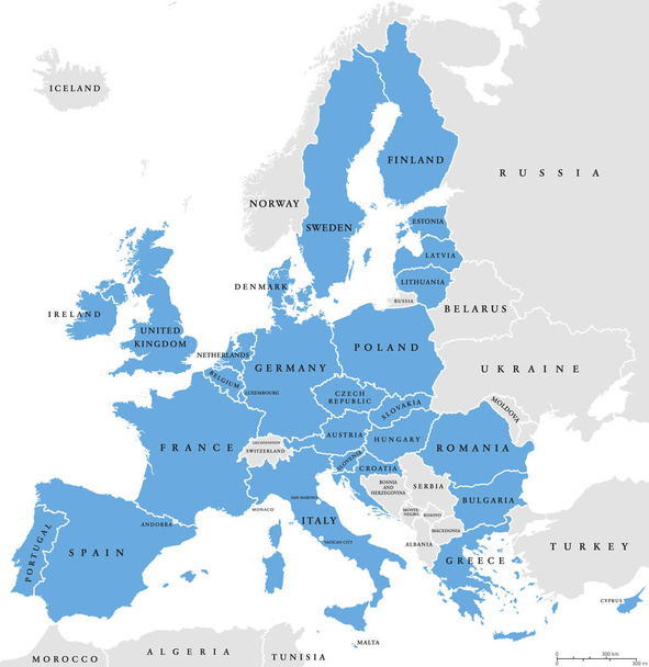
European Union countries. English labeling. Political map with borders and country names. 28 EU members, colored in light blue. Political and economic union in Europe. Illustration over white. Vector.
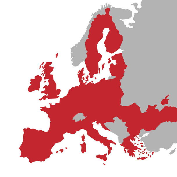
Vector red Map of the European Union with extra UE countries in grey on a White Background

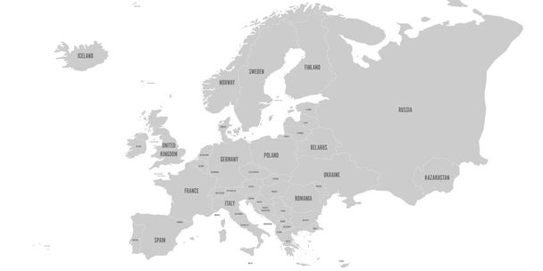
World map with names of sovereign countries and larger dependent territories. Simplified vector map in four shades of green on white background.

Political map of the world
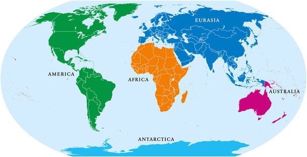
Five continents world, political map. Africa, America, Antarctica, Australia and Eurasia, with shorelines and borders. Robinson projection. English labeling. Isolated on white background. Vector.
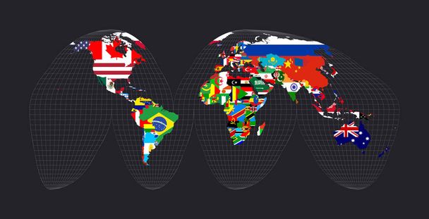
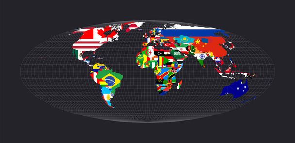
Map of the world with flags. Bogg's interrupted eumorphic projection. Map of the world with meridians on dark background. Vector illustration.
World map - America centered. Grey colored on dark background. High detailed political map of World with country, capital, ocean and sea names labeling.

Political map of the world

Arctic region countries and North Pole political map with national borders and country names. Arctic ocean without sea ice. English labeling and scaling. Illustration.

United States and China highlighted on political map of World. Vector illustration.

Political map of Europe and Africa. European cities. Political map with the border of the states. Urban areas
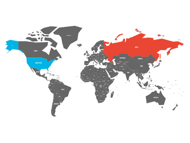
United States and Russia highlighted on political map of World. Vector illustration.
World map with flags. Goode's interrupted homolosine projection. Map of the world with meridians on dark background. Vector illustration.
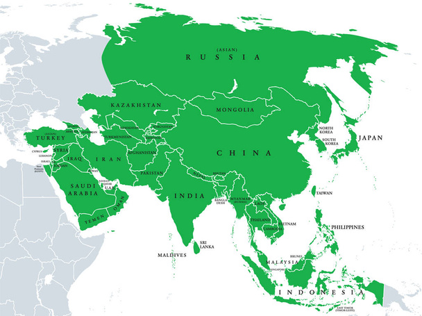
Asia, political map, states and countries of the largest continent. With the Asian part of Russia and Turkey and the Sinai Peninsula as African part. English labeling. Illustration over white. Vector.

United States and Russia highlighted on political map of World. Vector illustration.

Continent Asia, political map with colored single states and countries. With the Asian part of Russia and Turkey and Sinai Peninsula as African part. English labeling. Illustration over white. Vector.
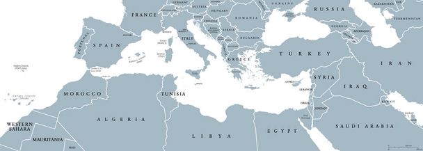
Mediterranean Basin political map. Mediterranean region, also Mediterranea. Lands around Mediterranean Sea. South Europe, North Africa and Near East. Gray illustration with English labeling. Vector.
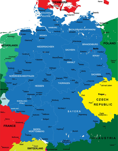
Political map of Germany with main cities
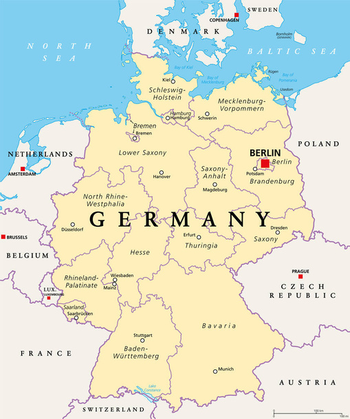
Germany, political map. States of the Federal Republic of Germany with capital Berlin and 16 partly-sovereign states. Country in Central and Western Europe. English labeling. Illustration. Vector.
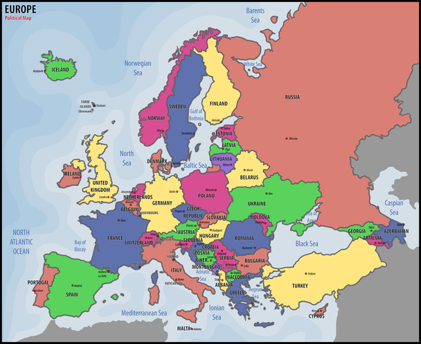
Europe Political Map

Denmark political map with capital Copenhagen and neighbor countries. Kingdom, Scandinavian and Nordic country in Europe. Gray illustration with English labeling on white background. Vector.
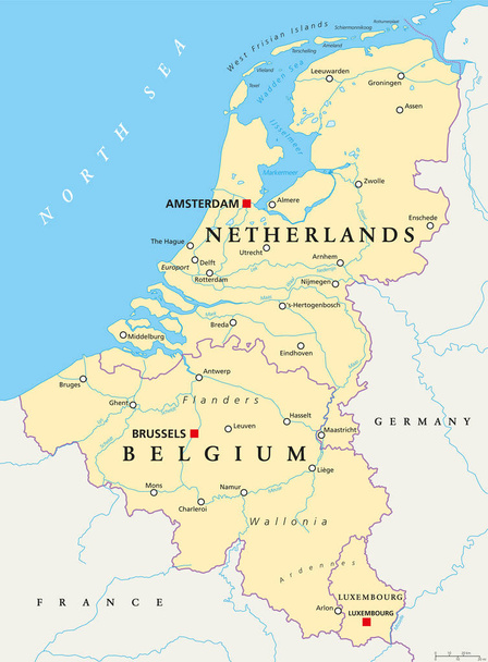
Benelux. Belgium, Netherlands and Luxembourg. Political map with capitals, borders and important cities. Benelux Union, a geographic, economic, cultural group. English labeling. Illustration. Vector.
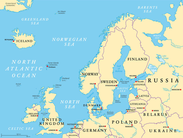
Northern Europe, political map. British Isles, Fennoscandia, Jutland peninsula, Baltic plain lying to the east, and the islands offshore from mainland Northern Europe and the main European continent.

Colorful London administrative and political map
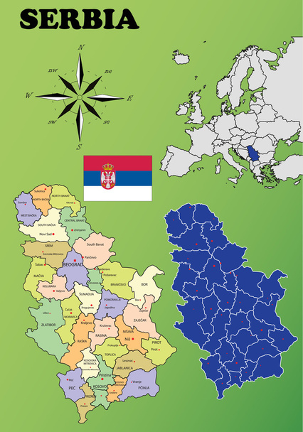
Serbia vector set. Isolated.
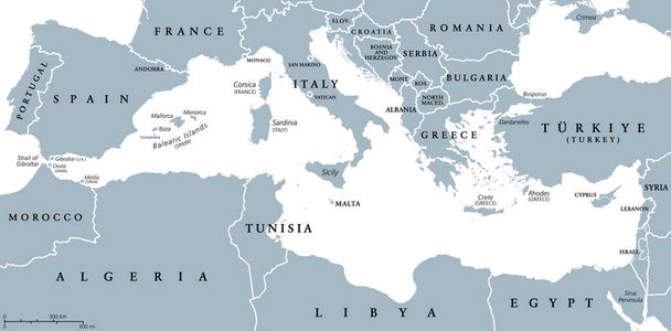
The Mediterranean Sea, gray political map with international borders, countries and islands. Connected to the Atlantic Ocean, surrounded by the Mediterranean Basin, almost completely enclosed by land.
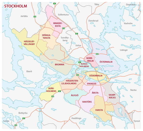
Administrative and political map of the Swedish capital Stockholm
Europe map. High detailed political map of european continent with country, capital, ocean and sea names labeling.
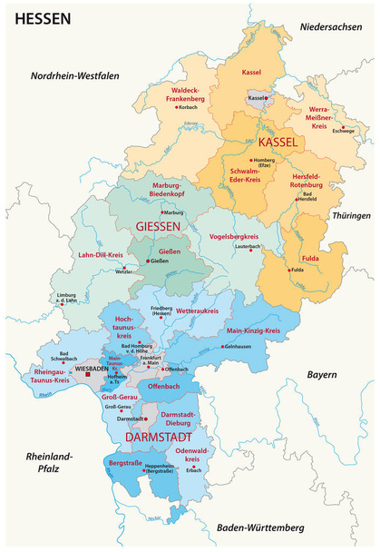
Hesse administrative and political map in german language

Southeast Europe Region. Map of countries of Balkan Peninsula. Vector illustration.

Netherlands political map with capital Amsterdam. Holland with national borders and neighbor countries. Gray illustration with English labeling and scaling on white background. Vector.
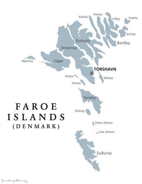
Faroe Islands political map with capital Torshavn, also the Faeroes. Autonomous country and part of the Kingdom of Denmark. Archipelago in North Atlantic. Gray illustration. English labeling. Vector.
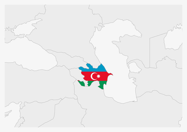
Azerbaijan map highlighted in Azerbaijan flag colors, gray map with neighboring countries.
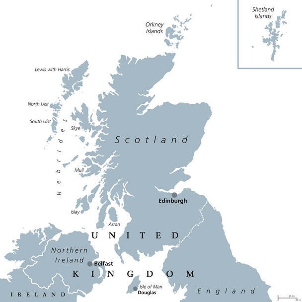
Scotland political map with capital Edinburgh. Country and part of the United Kingdom. Covers the northern third of the island of Great Britain. Gray illustration over white. English labeling. Vector.
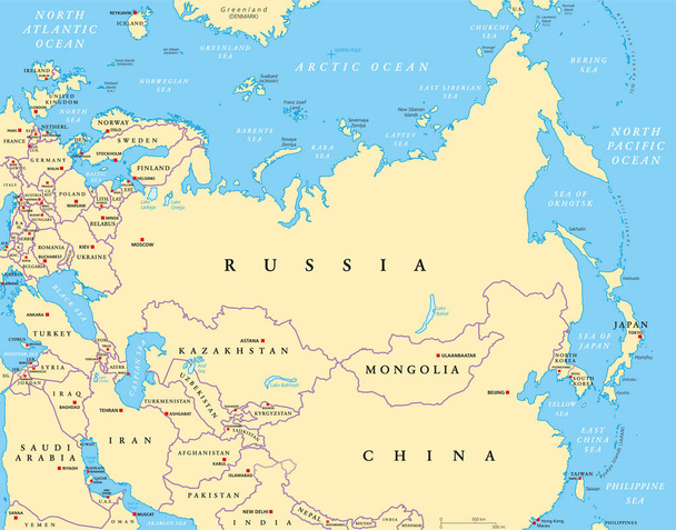
Eurasia political map with capitals and national borders. Combined parts of the continental landmass of Europe and Asia. English labeling. Vector.

Sardinia, Italian island, political map with capital Cagliari. Sardegna, Autonomous Region of Sardinia, second-largest island in the Mediterranean Sea, south of Corsica, west of the Italian Peninsula.
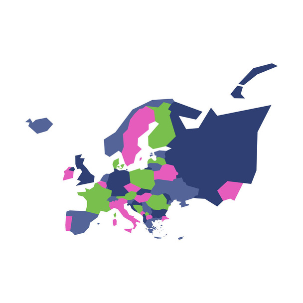
Very simplified infographical political map of Europe. Simple geometric vector illustration.
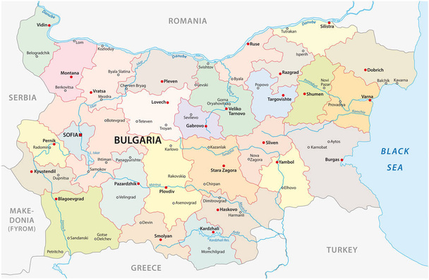
Bulgaria vector map with major cities and rivers

Highly detailed political map of Spain with all regions separate and the main cities

Romania Map - High Detailed Vector Illustration
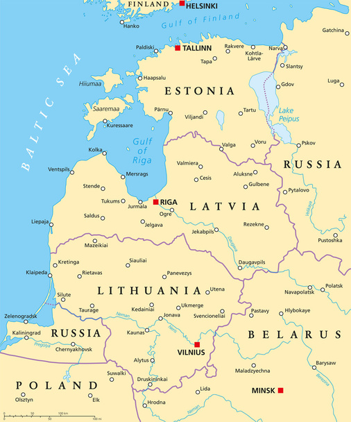
Baltic countries political map. Baltic states area with capitals, national borders, important cities, rivers and lakes. English labeling and scaling.
Worldmapwith flags of each country. Bromley projection. Map of the world with meridians on dark background. Vector illustration.
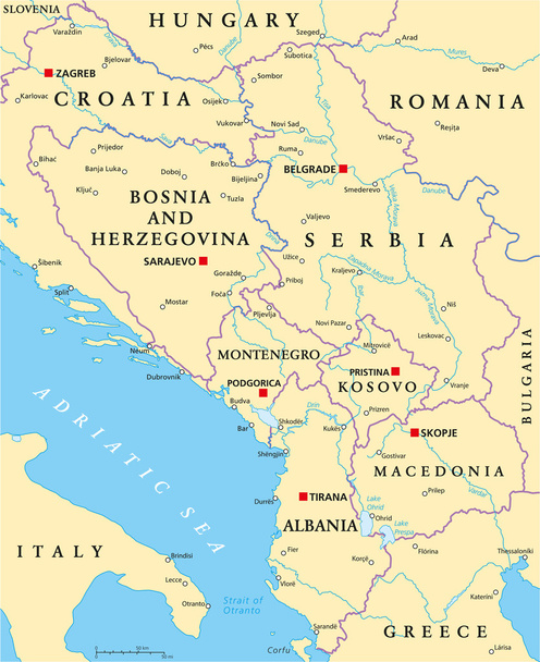
Central Balkan Political Map formed by Bosnia and Herzegovina, Serbia, Montenegro, Kosovo, Albania and Macedonia. With capitals, national borders, important cities, rivers and lakes. English labeling and scaling.
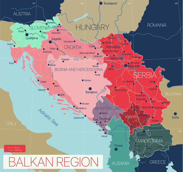
Balkan region detailed editable map with cities and towns, roads and railways. Vector EPS-10 file

Crimea political map. Peninsula in Eastern Europe on the northern coast of the Black Sea, with disputed status. Controlled and governed by Russia, internationally recognized as part of Ukraine. Vector
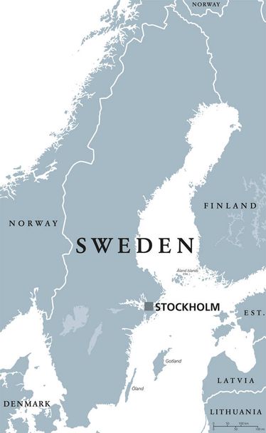
Sweden political map with capital Stockholm, national borders and neighbors. Kingdom and Scandinavian country in Northern Europe. Gray illustration with English labeling, isolated over white. Vector.
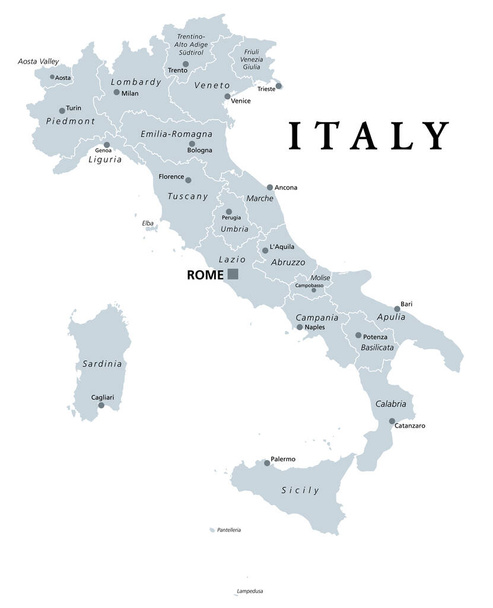
Italy, gray political map with administrative divisions. Italian Republic with capital Rome, 20 regions, their borders and capitals. English labeling. Isolated illustration on white background. Vector

Balearic Islands political map with capital Palma. Majorca, Minorca, Ibiza, Formentera. Spain autonomous community in Mediterranean Sea. Gray illustration on white background. English labeling. Vector
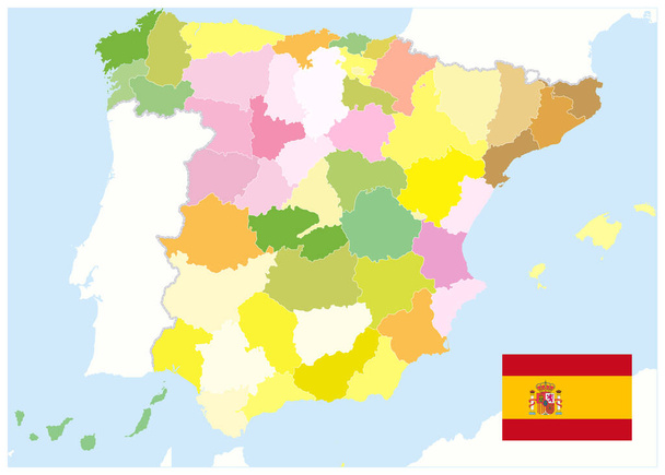
Administrative Political Map of Spain. No text. All elements are separated in editable layers clearly labeled. Vector illustration.
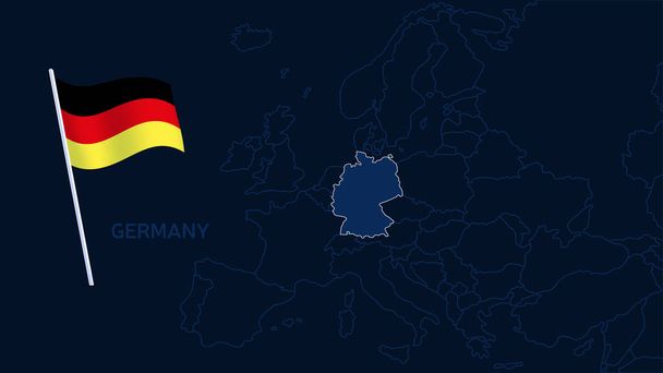
Germany on europe map vector illustration. High quality map Europe with borders of the regions on dark background with national flag.
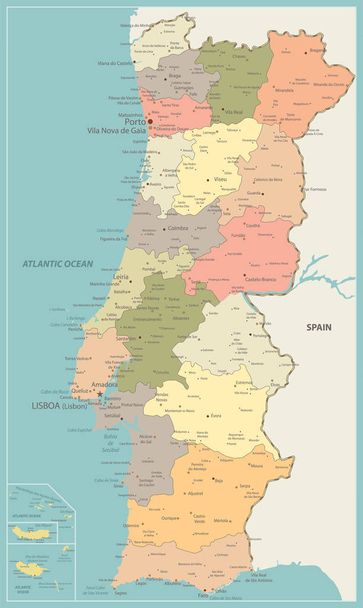
Portugal Political Map Vintage Color - Detailed map of Portugal vector illustration - All elements are separated in editable layers clearly labeled.

Switzerland on europe map vector illustration. High quality map Europe with borders of the regions on dark background with national flag.

Germany political map. Multicolored states of Federal Republic of Germany with capital Berlin and 16 partly-sovereign states. Central and Western Europe country. English labeling. Illustration. Vector

Channel Islands political map. Crown dependencies Bailiwick of Guernsey and Bailiwick of Jersey with capitals. Archipelago off the french coast of Normandy. English labeling. Illustration. Vector.
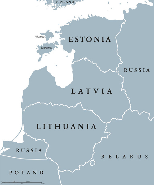
Baltic countries political map, also known as Baltics, Baltic nations or states. Estonia, Latvia and Lithuania with national borders. Gray illustration with English labeling and scaling over white.
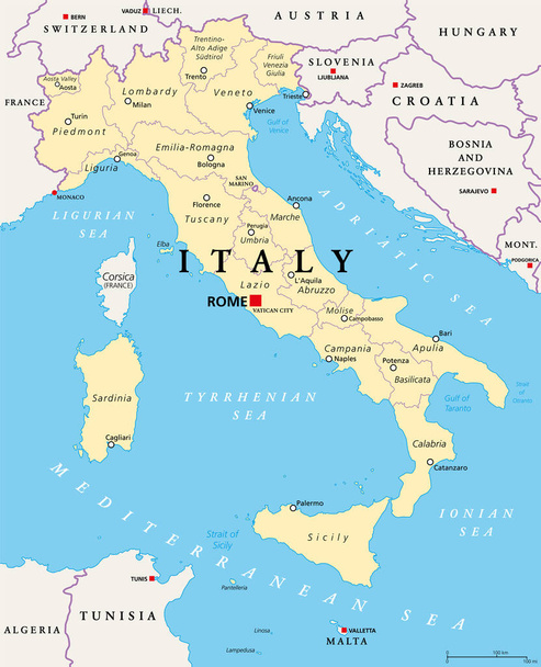
Italy, political map, administrative divisions. Italian Republic with capital Rome, 20 regions and their capitals, international borders and neighbor countries. English labeling. Illustration. Vector.
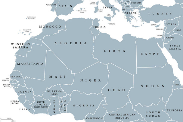
North Africa countries political map with borders. English labeling. From Atlantic shores of Morocco to the Red Sea. Maghreb and Mediterranean countries. Gray illustration on white background. Vector.
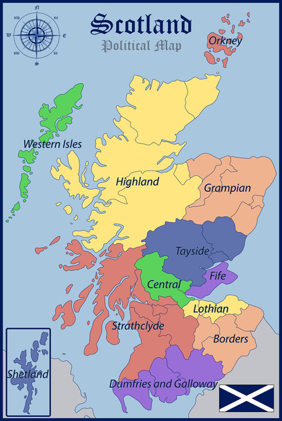
Illustration of a Political Map and Flag of Scotland
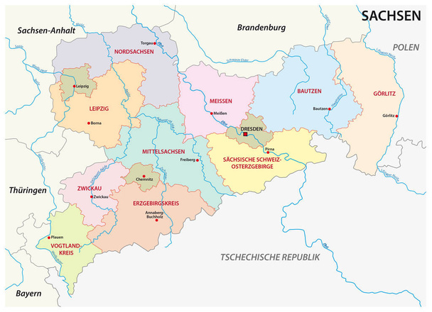
Saxony administrative and political map in german language
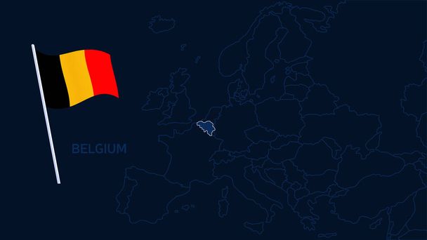
Belgium on europe map vector illustration. High quality map Europe with borders of the regions on dark background with national flag.
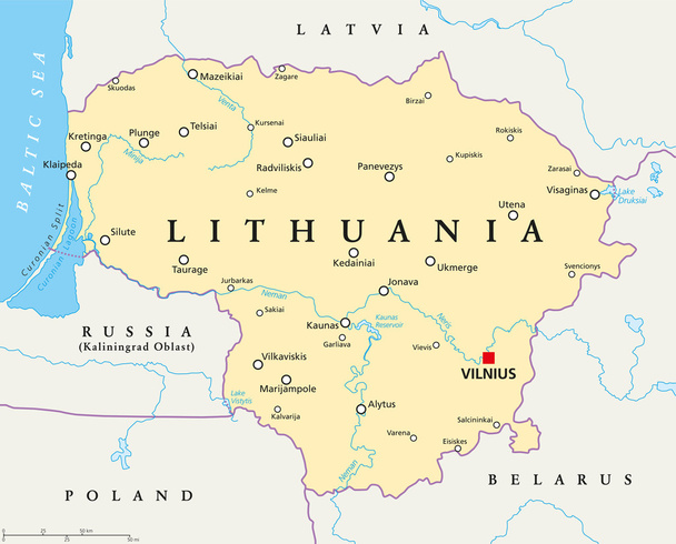
Lithuania political map with capital Vilnius, national borders, important cities, rivers and lakes. English labeling and scaling. Illustration.
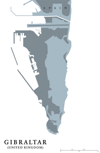
Gibraltar political map. British Overseas Territory on southern end of Iberian Peninsula. The Rock of Gibraltar shares its northern border with Spain. Gray illustration with English labeling. Vector.
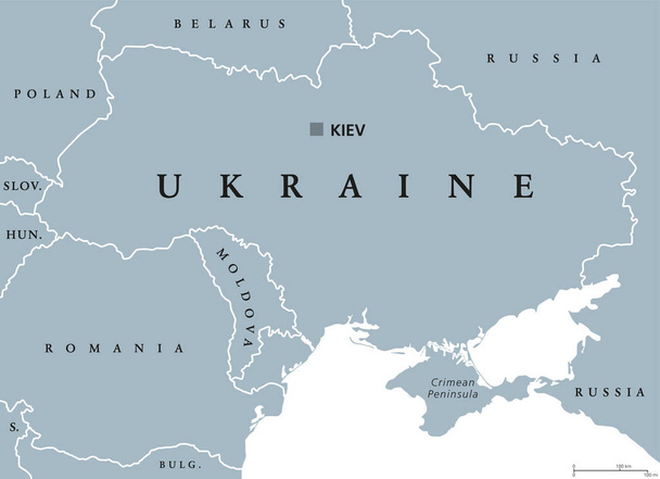
Ukraine political map with capital Kiev, national borders, Crimean Peninsula and neighbor countries. State in Eastern Europe. Gray illustration isolated on white background. English labeling. Vector.
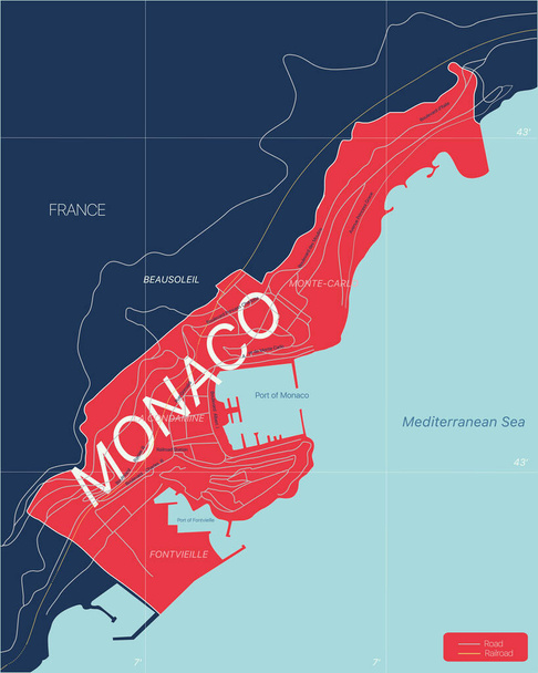
Monaco country detailed editable map with regions cities and towns, roads and railways, geographic sites. Vector EPS-10 file