


Filters

Stock royalty-free photos and images of Los angeles county
Discover unlimited high resolution images of Los angeles county and stock visuals for commercial use.

A Seagull relaxing on the San Buenaventura State beach, Ventura, Ventura County, California

Lemon Tree Orchards in the Santa Clara River Valley, Fillmore, Ventura County, California

Aerial helicopter shot of Ventura

Aerial helicopter shot of Ventura
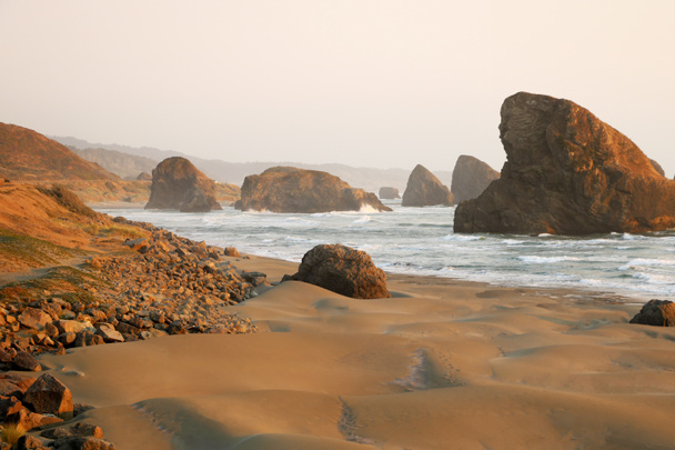
Sandy beach of the Pacific coast with rocks.
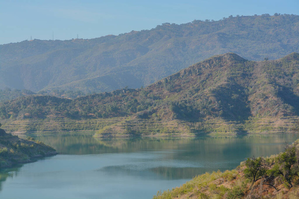
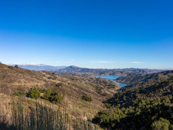
Beautiful Lake Casitas in the rugged mountains of Ventura, Ventura County, California

Beautiful Lake Casitas in the rugged mountains of Ventura, Ventura County, California
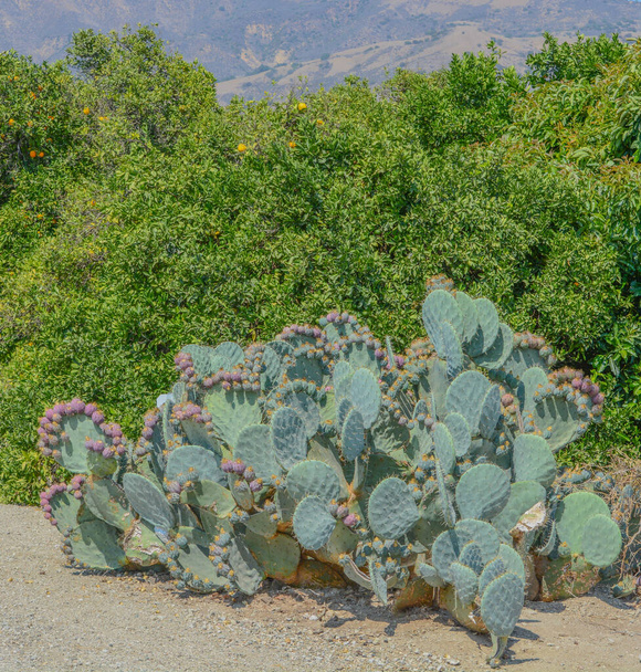
Prickly Pear Cactus with fruit in Santa Clara River Valley, Ventura County, Fillmore, California

Downtown Ojai California after a winter snow in the mountains

Panorama of Ojai Valley and surrounding mountains and farmlands

Snow covered Topa bluffs over Ojai Valley farms and vineyards
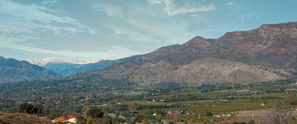
Panorama of Ojai Valley and surrounding mountains and farmlands

Panorama of Ojai Valley and surrounding mountains and farmlands

Snow covered Chief Peak high above the Ojai Valley in winter
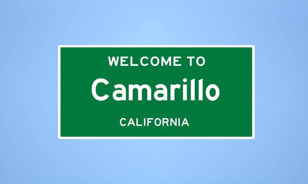
Isolated US city limit sign of Camarillo, located in Ventura county, California. Place name sign from the USA on blue background.
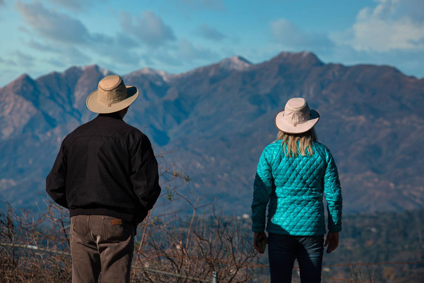
Couple looks out over the Ojai Valley after a light snow
Aerial view of Leo Carrillo State Park and Pacific Coast Highway in Malibu, California. High quality photo

Front entrance to the historic Ventura City Hall building in Southern California.

Front entrance to the historic Ventura City Hall building in Southern California.

Beautiful Peach Rose in the Santa Clara River Valley, Fillmore, California

Beautiful Peach Rose in the Santa Clara River Valley, Fillmore, California

Oxnard California USA. High quality photo

Oxnard California USA. High quality photo

Aerial helicopter shot of the Channel Islands
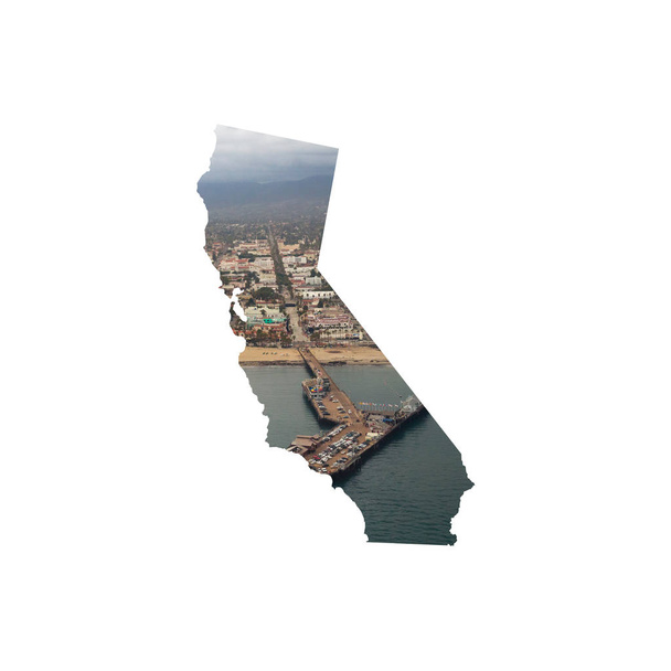
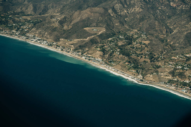
Silhouette of California featuring aerial photo of coast near Ventura

Aerial helicopter shot of the Channel Islands

Aerial helicopter shot of the Channel Islands

Aerial helicopter shot of the Channel Islands
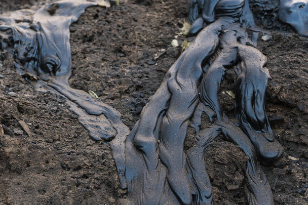
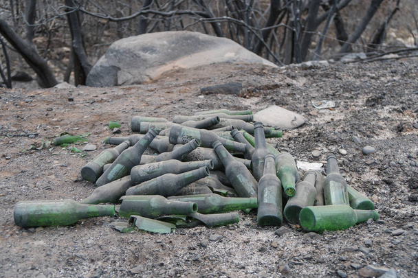
Glass and metal garbage exposed by the Thomas Fire along Highway 150 near Lake Casitas.

Glass and metal garbage exposed by the Thomas Fire along Highway 150 near Lake Casitas.
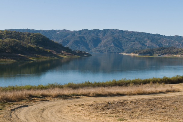
Lake Casitas, a reservoir in Ventura County, California
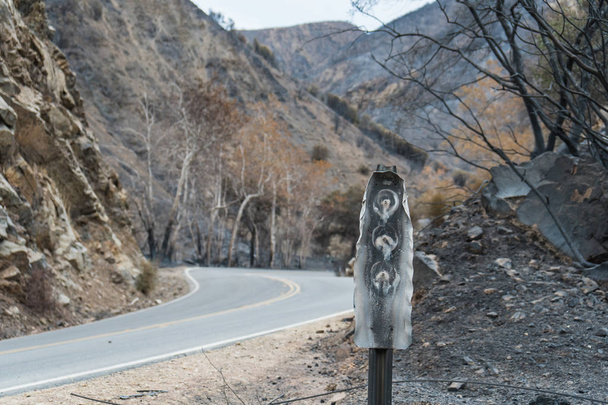
Road and highway signs damaged by the Thomas Fire along Highway 33 in Ojai, California
Aerial helicopter shot of Carpinteria

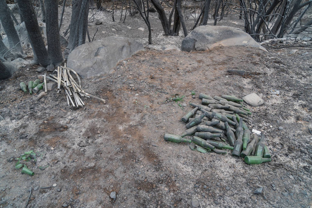
Collected glass bottles and views of Thomas Fire damage in the hills around Lake Casitas in Ojai, California

This pier was originally built in 1872, making it one of California's oldest wooden piers.
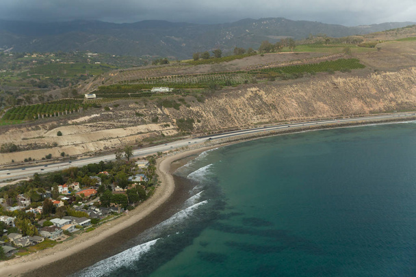
Aerial helicopter shot of Carpinteria
Campground and road damaged by the Thomas Fire along Highway 33 in Ojai, California
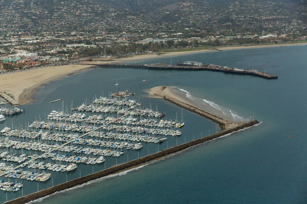
Aerial helicopter shot of Santa Barbara
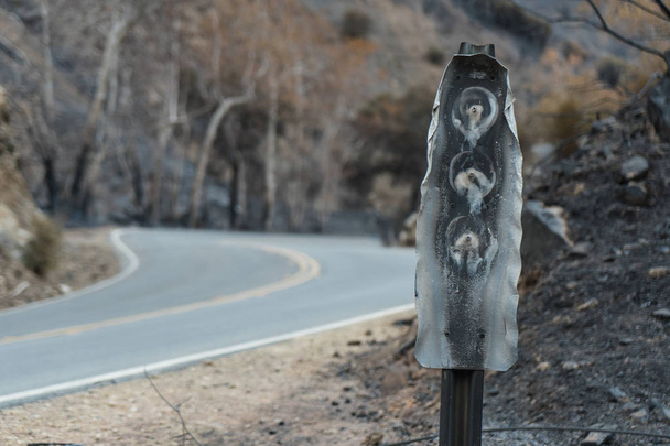
Road and highway signs damaged by the Thomas Fire along Highway 33 in Ojai, California
Sign damaged by the Thomas Fire along Highway 33 in Ojai, California
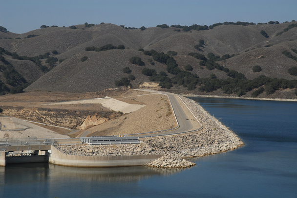
Dam access road, Lake Casitas, California
Rose Valley campground damaged by the Thomas Fire along Highway 33 in Ojai, California
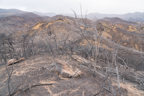
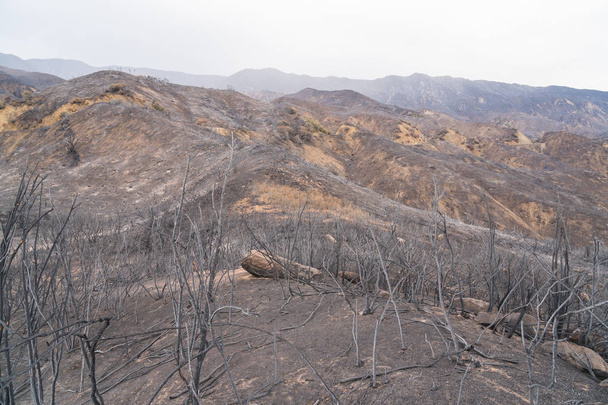
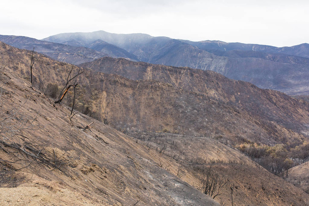
Burned landscape along Highway 150 near Lake Casitas. Aftermath of Thomas Fire.

Aerial helicopter shot of Carpinteria

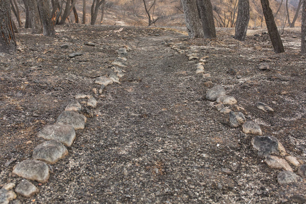
Pine trees and walking path damaged by the Thomas Fire along Highway 33 in Ojai, California
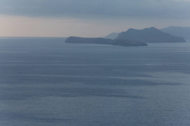
Aerial helicopter shot of the Channel Islands
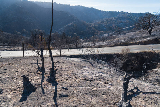
Burned landscape along Highway 150 near Lake Casitas. Aftermath of Thomas Fire.

A grouping of volcanic rock formations at East Anacapa Island in Channel Islands National Park off the coast of Ventura, California.
Aerial helicopter shot of Santa Barbara
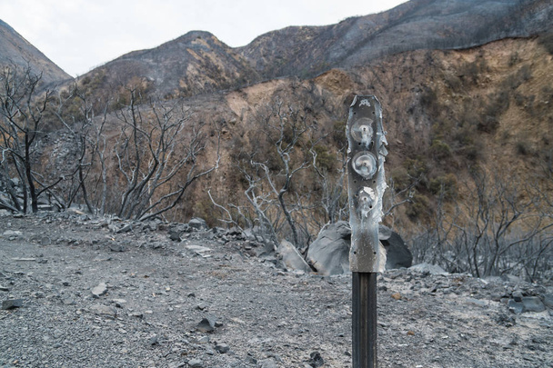
Road and highway signs damaged by the Thomas Fire along Highway 33 in Ojai, California
Burned landscape along Highway 150 near Lake Casitas. Aftermath of Thomas Fire.

Aerial helicopter shot of Carpinteria

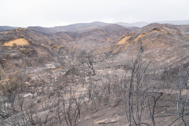
Views of Thomas Fire damage in the hills around Lake Casitas in Ojai, California
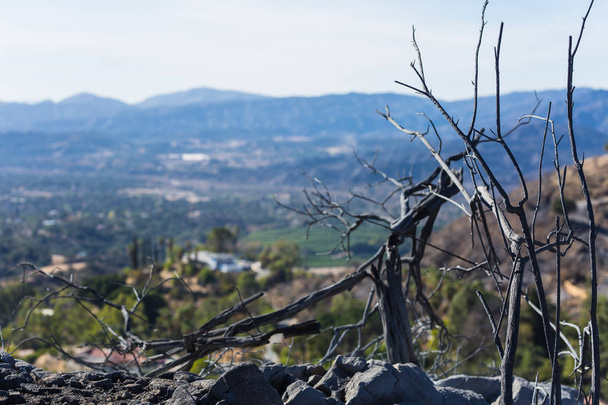
Vegetation damaged by Thomas Fire with the green Ojai Valley in background
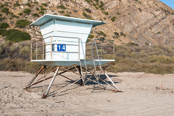
Lifeguard tower on Mugu Beach, in Malibu, California, which lies along the scenic Pacific Coast Highway.

Aerial helicopter shot of Santa Barbara
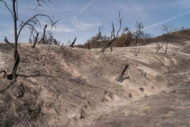
Burned landscape along Highway 150 near Lake Casitas. Aftermath of Thomas Fire.
Exposed garbage in landscape damaged by the Thomas Fire along Highway 33 in Ojai, California
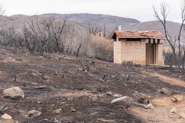
Small brick restroom in landscape damaged by the Thomas Fire along Highway 33 in Ojai, California
Glass and metal garbage exposed by the Thomas Fire along Highway 150 near Lake Casitas.
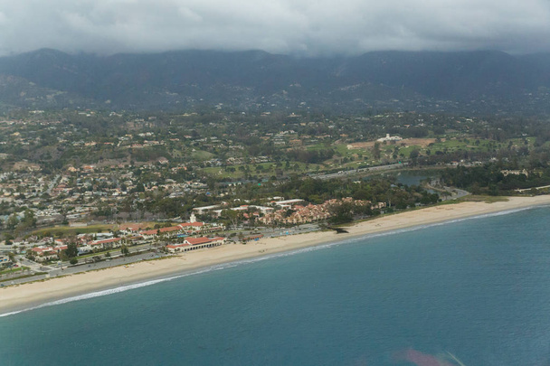
Aerial helicopter shot of Santa Barbara
Exposed garbage in landscape damaged by the Thomas Fire along Highway 33 in Ojai, California
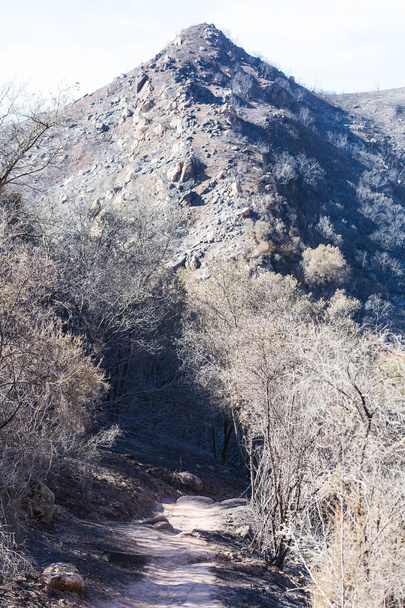
Landscape damaged by the Thomas Fire along the Pratt Trail in Ojai, California
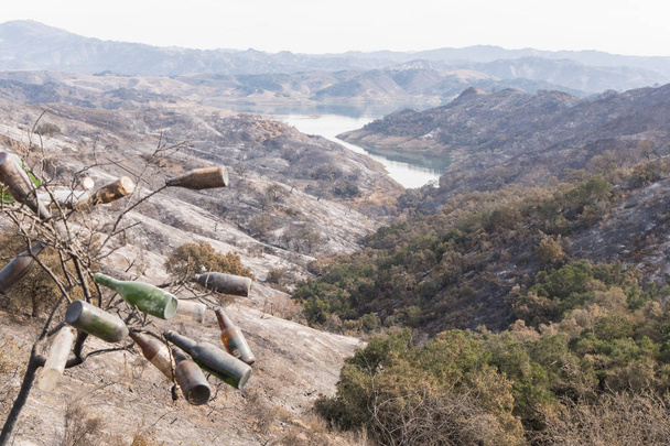
Collected glass bottles and views of Thomas Fire damage in the hills around Lake Casitas in Ojai, California
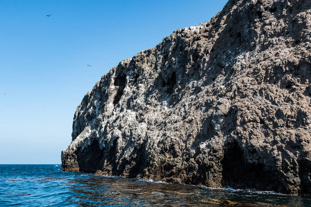
Close-up of the volcanic rock which makes up Anacapa Island in Channel Islands National Park 11 miles off the coast of Ventura, California.

Aerial helicopter shot of Santa Barbara
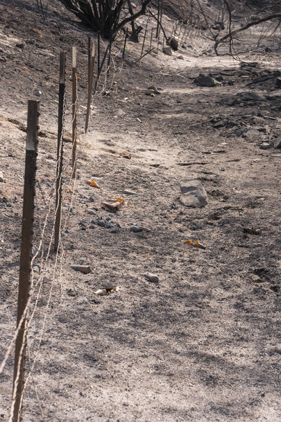
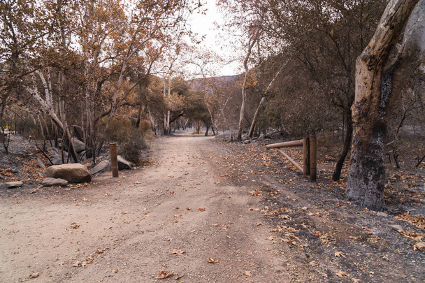
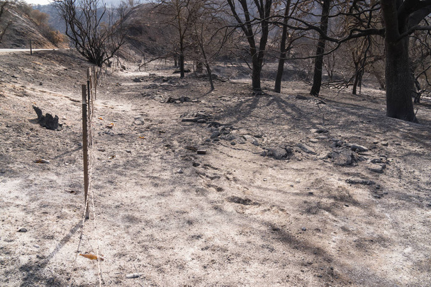
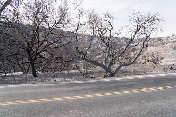
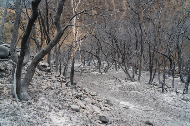
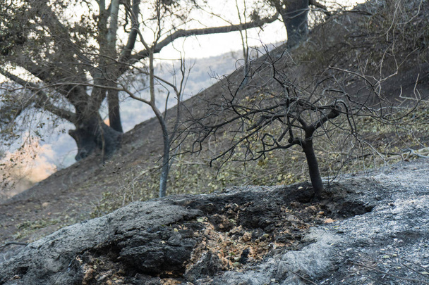
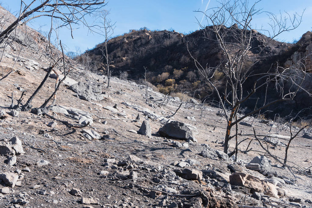
Landscape damaged by the Thomas Fire along Highway 33 in Ojai, California

Landscape damaged by the Thomas Fire along Highway 33 in Ojai, California
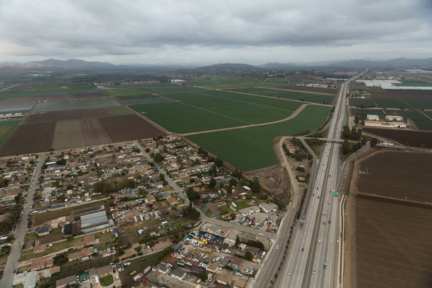
Aerial helicopter shot of Oxnard
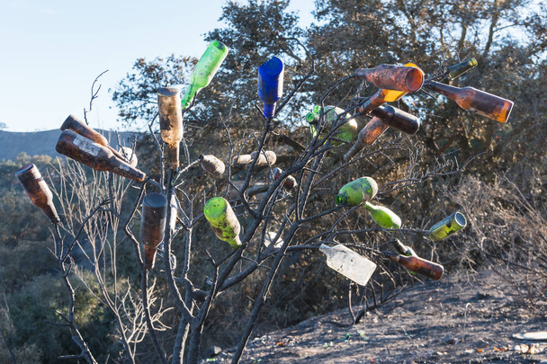
Collected glass bottles and views of Thomas Fire damage in the hills around Lake Casitas in Ojai, California

Yucca trees damaged by the Thomas Fire along Highway 33 in Ojai, California
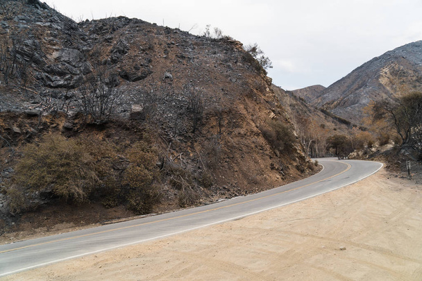
Road and highway signs damaged by the Thomas Fire along Highway 33 in Ojai, California
Aftermath of Thomas Fire on Highway 150. Burned hillside and natural oil seeps still smoking.

Landscape damaged by the Thomas Fire along Highway 33 in Ojai, California

Glass and metal garbage exposed by the Thomas Fire along Highway 150 near Lake Casitas.
Aftermath of Thomas Fire on Highway 150. Burned hillside and natural oil seeps still smoking.

Aftermath of Thomas Fire on Highway 150. Burned hillside and natural oil seeps still smoking.

Aftermath of Thomas Fire on Highway 150. Burned hillside and natural oil seeps still smoking.
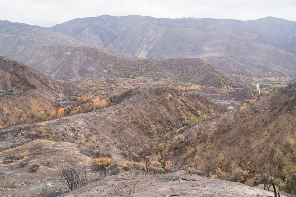
Elevated panorama of Lake Casitas 2 years after the Thomas fire
Landscape damaged by the Thomas Fire along Highway 33 in Ojai, California
Exposed garbage in landscape damaged by the Thomas Fire along Highway 33 in Ojai, California
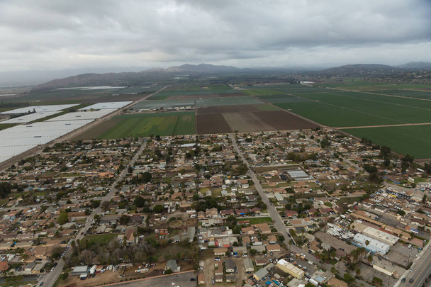
Aerial helicopter shot of Oxnard
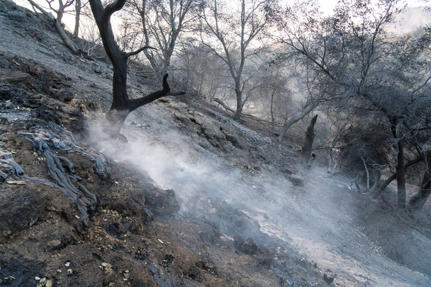
Aftermath of Thomas Fire on Highway 150. Burned hillside and natural oil seeps still smoking.
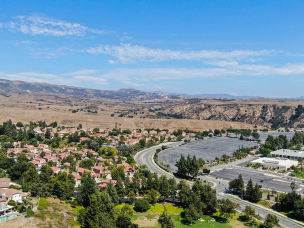
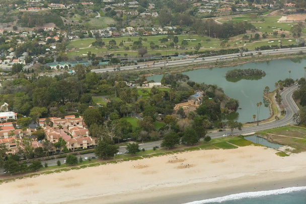
Aerial view of small neighborhood with dry desert mountain on the background in Moorpark, Ventura County in Southern California. USA

Glass and metal garbage exposed by the Thomas Fire along Highway 150 near Lake Casitas.

Rock formations at East Anacapa Island in Channel Islands National Park off the coast from Ventura, California.
Landscape damaged by the Thomas Fire along the Pratt Trail in Ojai, California
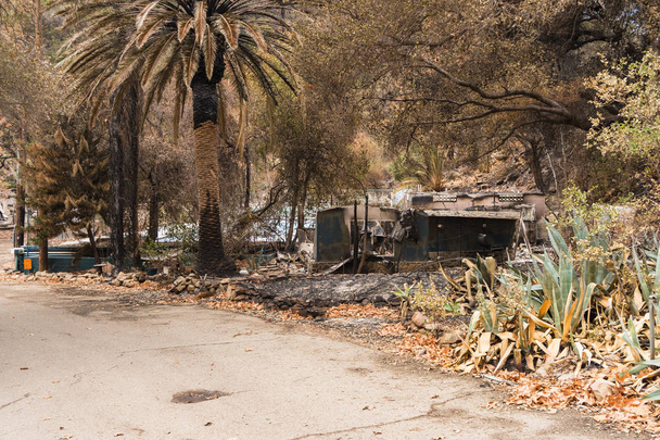
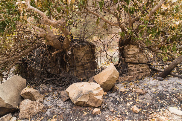
Buildings and property at Matilija Hot Springs damaged by the Thomas Fire along Highway 33 in Ojai, California
Landscape damaged by the Thomas Fire along Highway 33 in Ojai, California
Landscape damaged by the Thomas Fire along Highway 33 in Ojai, California
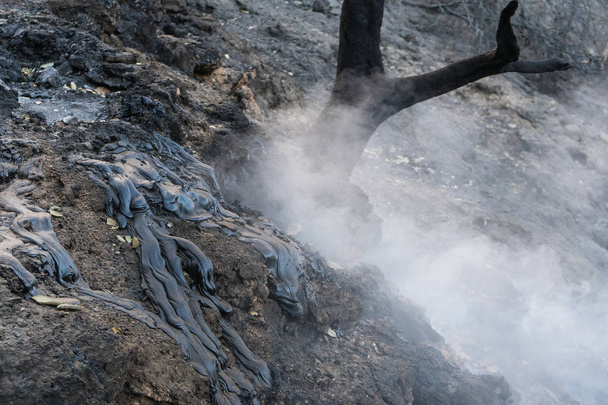
Aftermath of Thomas Fire on Highway 150. Burned hillside and natural oil seeps still smoking.
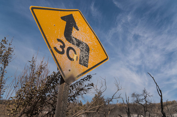
Road sign damaged by Thomas Fire along Highway 150
Exposed garbage in landscape damaged by the Thomas Fire along Highway 33 in Ojai, California

Glass and metal garbage exposed by the Thomas Fire along Highway 150 near Lake Casitas.

Landscape damaged by the Thomas Fire along the Pratt Trail in Ojai, California
Aerial helicopter shot of Santa Barbara
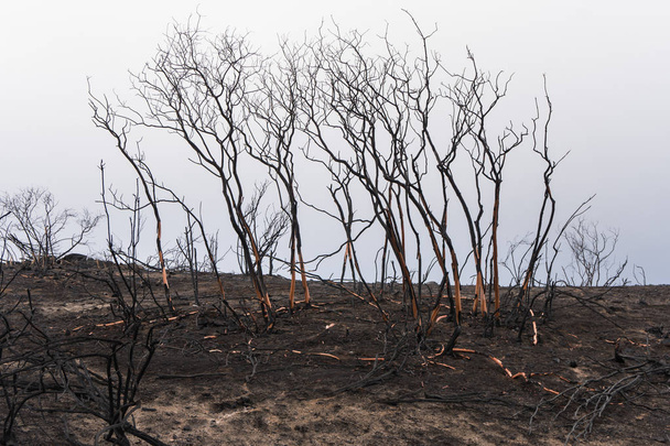
Manzanita trees damaged by the Thomas Fire along Highway 33 in Ojai, California
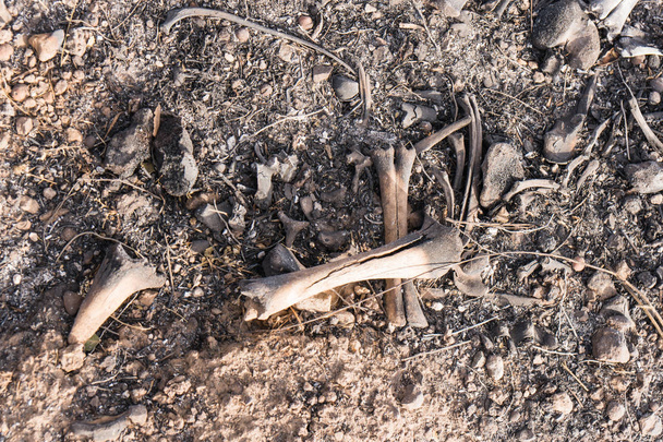
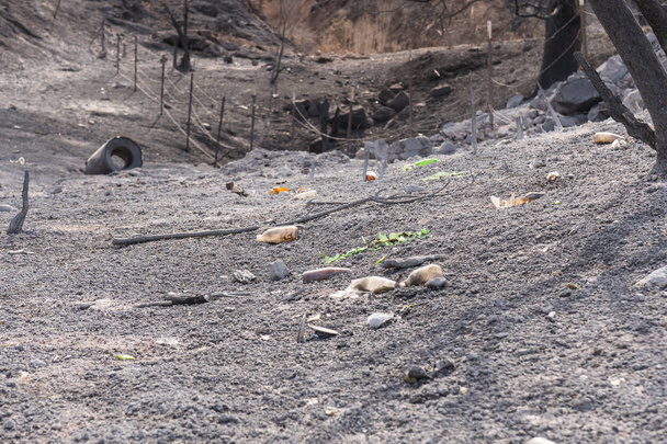
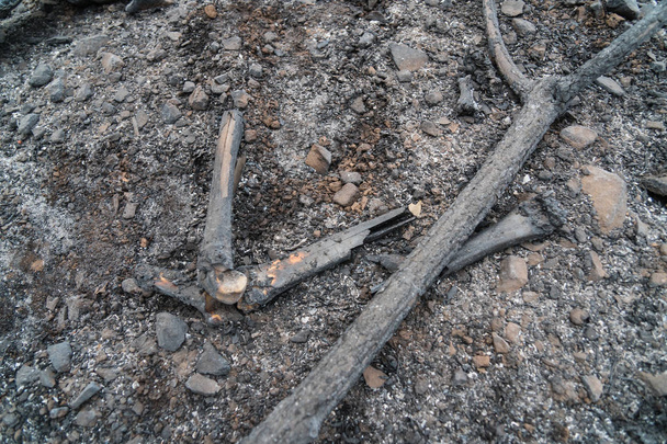
Charred bones of a dead animal exposed by the Thomas Fire along Highway 150
Landscape damaged by the Thomas Fire along Highway 33 in Ojai, California
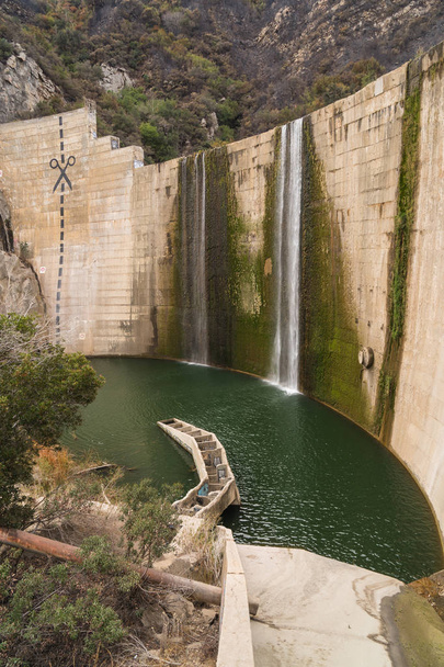
Abandoned and obsolete Matilija dam and outbuildings in Ojai, California